At dusk on the Shimanto River, the fishermen stand on the chinkabashi (沈下橋, submersible bridges built without railings to sit low against the water) in a way that is difficult to explain to someone who has not seen it. The planks run close to the surface. When the river floods, the bridge goes under. The current runs over it. The bridge does not wash away because it was designed to flood, not resist. In the evenings the water is low, and the bridges are dry, and the men fish from them in the ordinary way. Kochi
At dusk on the Shimanto River, the fishermen stand on the chinkabashi (沈下橋, submersible bridges built without railings to sit low against the water) in a way that is difficult to explain to someone who has not seen it. The planks run close to the surface. When the river floods, the bridge goes under. The current runs over it. The bridge does not wash away because it was designed to flood, not resist. In the evenings the water is low, and the bridges are dry, and the men fish from them in the ordinary way.
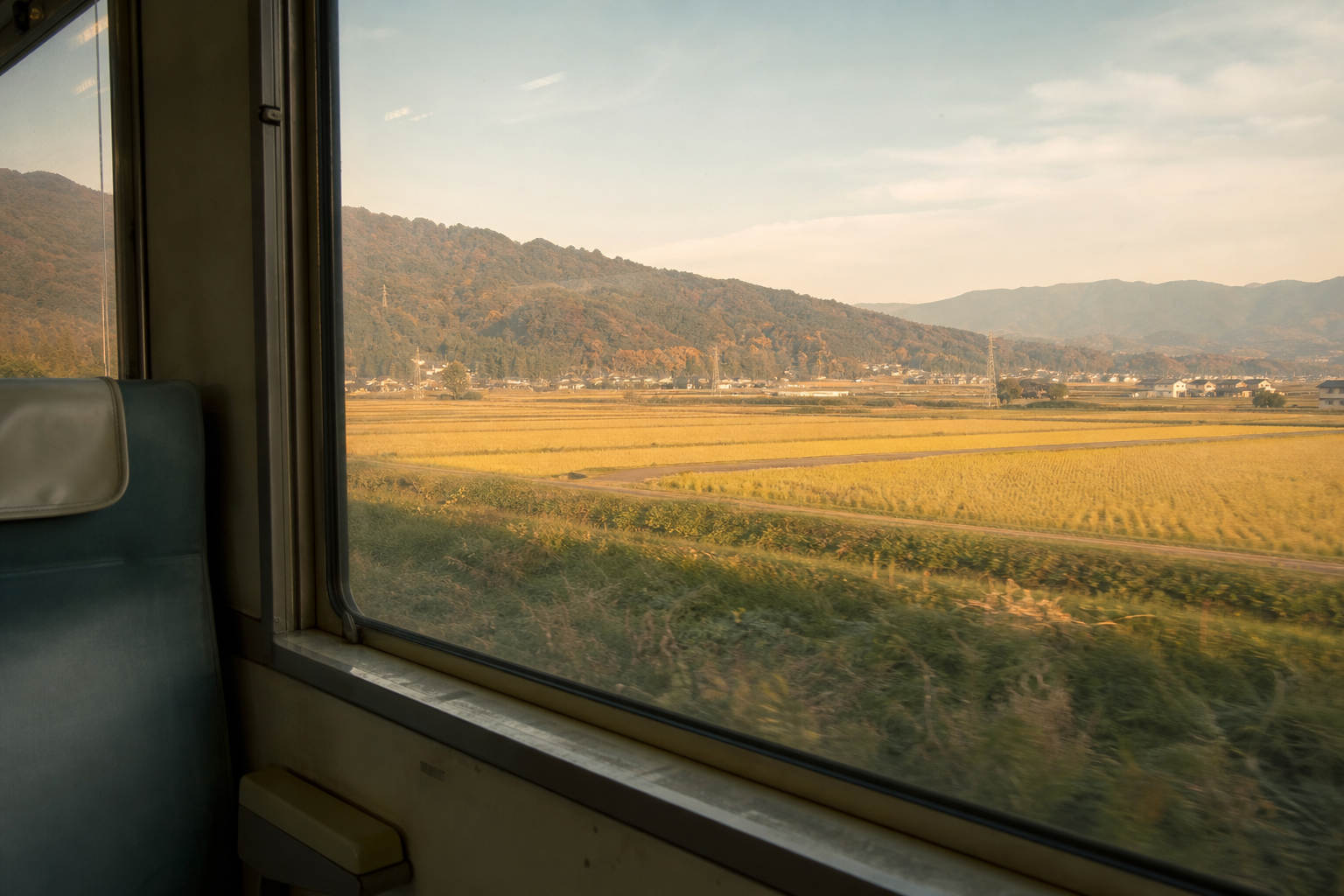
Kochi Prefecture (高知県) is the largest of Shikoku’s four prefectures and faces the Pacific Ocean on its southern edge. The old provincial name is Tosa (土佐), and the Tosa character is often described in Japan as direct and independent: a reputation shaped, local histories suggest, by the prefecture’s geographic distance from the administrative centers of Japanese power. The Pacific side of the island receives heavy rainfall. The rivers run long and steep. The prefecture has a population of around 650,000, a considerable area relative to that number, and a pace that follows rivers and coastline rather than any urban corridor.
—
What Is Kochi?
Kochi Prefecture occupies the southern quarter of Shikoku. Its main geographic facts are three: the Pacific coastline along the south, the Shikoku mountain range running through the interior, and the rivers that descend from those mountains to the sea. The Shimanto River (四万十川) is the most famous of these, known across Japan for its largely undammed lower reaches. The Niyodo River (仁淀川) runs parallel to the north, recognized for a different reason. The Yoshino River (吉野川) begins in Kochi’s northern mountains before flowing east into Tokushima.
Kochi City, the prefectural capital, is manageable on foot: a street-level city with a Sunday morning outdoor market, Hirome Ichiba as a covered food market where locals eat together at communal tables, and Kochi Castle (高知城) on a small hill above the town. The castle is one of Japan’s twelve surviving original castle structures. A few kilometers outside the city, the countryside opens and the rivers take over.
Sakamoto Ryoma (坂本龍馬), one of the figures credited with hastening the Meiji Restoration, was born in Tosa Province. His presence in Kochi’s public memory is prominent: statues, a museum, and a broad association with local independence. This connection is how Kochi narrates itself. Whether it is historically precise is a question historians weigh differently, but the self-image matters because it shapes how the prefecture presents its character to outsiders.
—
The Shimanto River
What the Absence of Dams Means
The Shimanto River has no large dams along its main channel. In Japan, where most rivers of significant size have been dammed for flood control and power generation, this is notable. Local opposition to dam construction across several decades preserved the character of the lower river. The result is water that moves with the quality of an uninterrupted river: clear in low-flow periods, fast and brown after typhoons, running from mountain headwaters to the Pacific without the pauses that dams create.
The Chinkabashi and the River’s Logic
The chinkabashi are the physical expression of a community that accommodated the river’s habits rather than trying to overcome them. There are approximately 47 of these low bridges along the Shimanto and its tributaries. They sit close to the water, sometimes a few centimeters above the surface at normal flow, and they are built without railings so there is nothing for the current to catch when the river rises. The design is ancient in principle and still functional today.
Driving or cycling the road alongside the lower Shimanto offers a view of most of the chinkabashi. The road is narrow and the river is wide and the pace is set by both. The Shimanto River tourism site (in Japanese, with limited English) covers access points and seasonal road conditions.
Utsubo and the River-to-Sea Kitchen
The Shimanto region produces an unusual local ingredient: utsubo (ウツボ, moray eel), a creature associated more typically with ocean reef environments than with river systems. Near the Shimanto’s lower reaches, where the river meets the sea, utsubo is caught in tidal and estuarial waters and prepared as a local specialty: as tataki (seared and finely chopped) or grilled over charcoal. The flavor is mild and the texture dense. It appears on menus in the small riverside towns as an ordinary local food rather than a novelty item. Quiet travel in Kochi often includes meals like this: specific to the place and uncelebrated.
—
Niyodo Blue
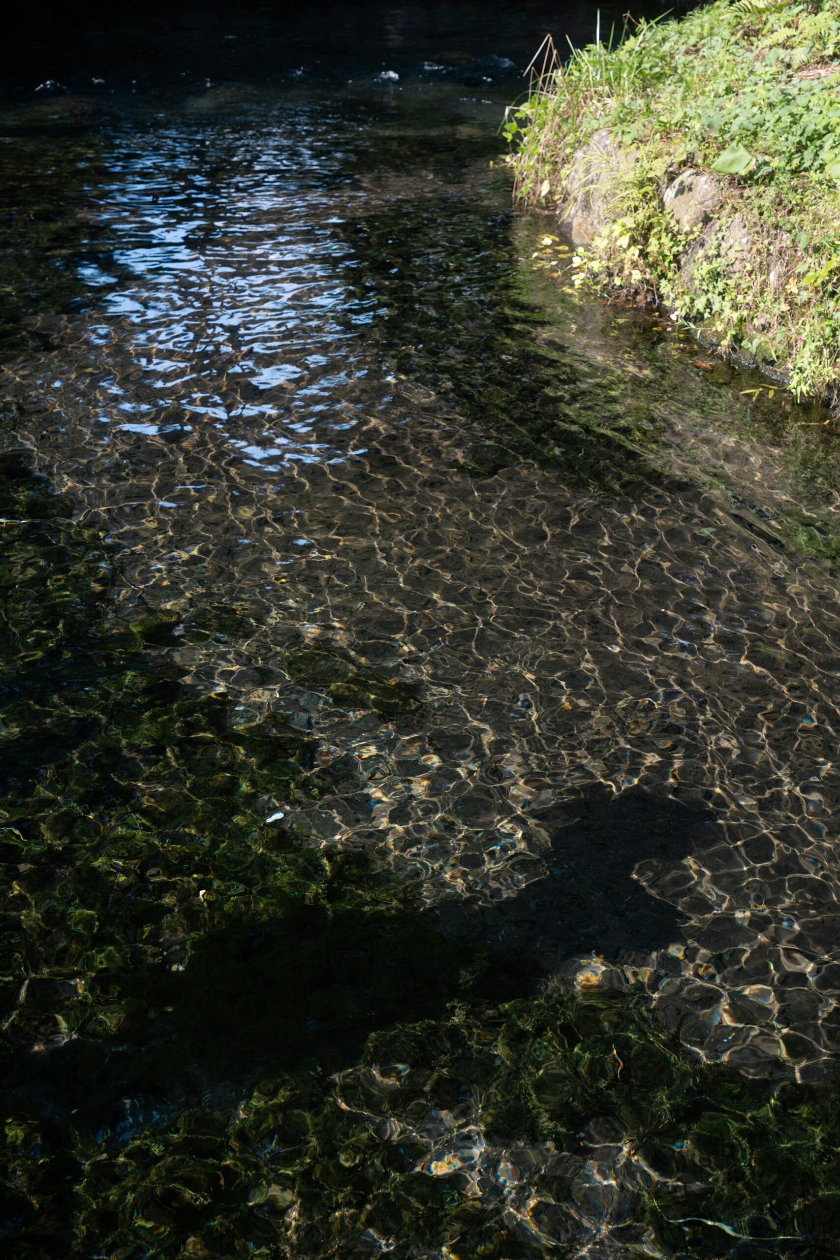
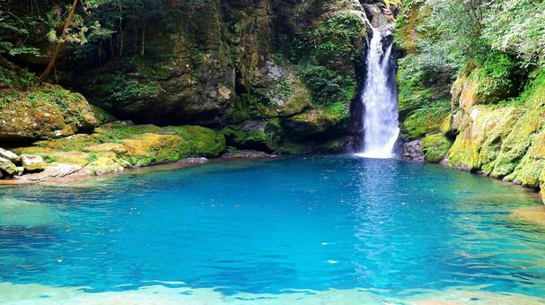
The Niyodo River (仁淀川) runs west through Ehime and into Kochi before reaching the sea near Susaki. Its water quality is consistently ranked among the highest in Japan by the Ministry of Land, Infrastructure, Transport and Tourism. In the deeper upstream pools, the water has a specific visual quality: a blue-green color produced by exceptional clarity and the way light refracts at depth. “Niyodo Blue” (仁淀ブルー) is now a recognized phrase in Japanese travel and photography. It names something directly observable: a particular shade in a particular river, not a general quality of cleanliness.
The Niyodo River official site (primarily in Japanese) carries information on river access and the annual water quality reports that have built the Niyodo’s reputation.
One frequently photographed point on the upper Niyodo is Nikobuchi (にこ淵), a deep pool fed by a small waterfall, accessible by a short trail from a roadside parking area. The water holds a deep blue-green color in clear weather, intensified by the shadows of the surrounding cedar forest. On weekends in warmer months it draws visitors, but the pool is small and the forest dense enough that the scale stays close regardless of crowd size.
The Color and Its Source
Nikobuchi and the Upstream Scale
The towns along the upper Niyodo are small. Most have seen population decline over several decades. For a traveler moving through Kochi’s interior, the upper Niyodo offers what rural Japan often offers: a place where agricultural rhythms and seasonal sounds are the main facts of each day, and where the river is present in daily life rather than displayed for viewing.
—
Montbell Outdoor Village Motoyama
Motoyama (本山町) is a small town in northern Kochi, positioned near the upper Yoshino River in the Reihoku area. Like many mountain towns across rural Japan, it has seen its population thin over several decades as younger residents moved to cities.
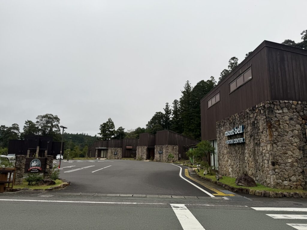
In 2019, Montbell (モンベル), one of Japan’s major outdoor equipment brands, opened an outdoor base there: the Montbell Outdoor Village Motoyama. The site includes a campground, river-based outdoor activity programs, local food from area producers, and connections to agricultural work that continues around the town. Current information on programs and reservations is available at the Montbell Outdoor Village Motoyama page.
The model is one that has appeared in various forms across rural Japan: an organization with broad reach anchors itself in a place that has natural assets but few visitors, and the outdoor base becomes part of the town’s identity over time. What makes it worth noting for quiet travel in Kochi is that it is a functional rather than resort-style operation. The pace is defined by the river and the season. Visitors come to use a place that is already there, not to consume something built for their benefit.
The Mind piece on the aesthetics of subtraction addresses, in a different register, why this kind of simplicity carries meaning in Japan.
—
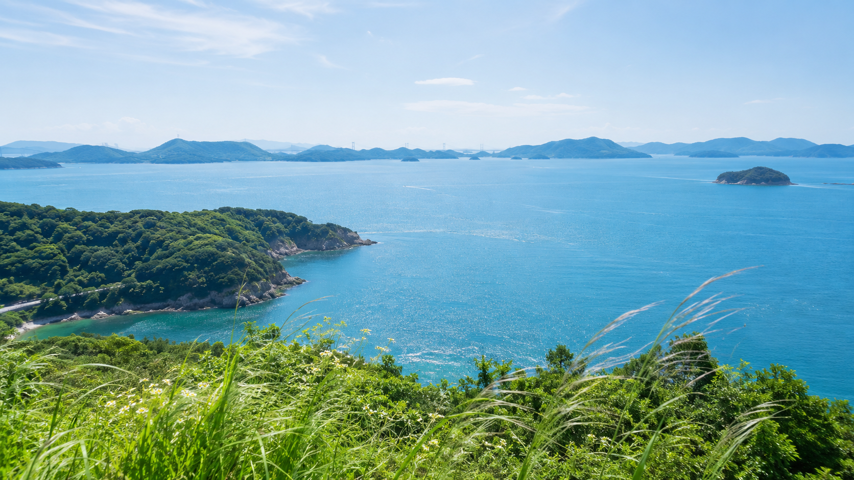
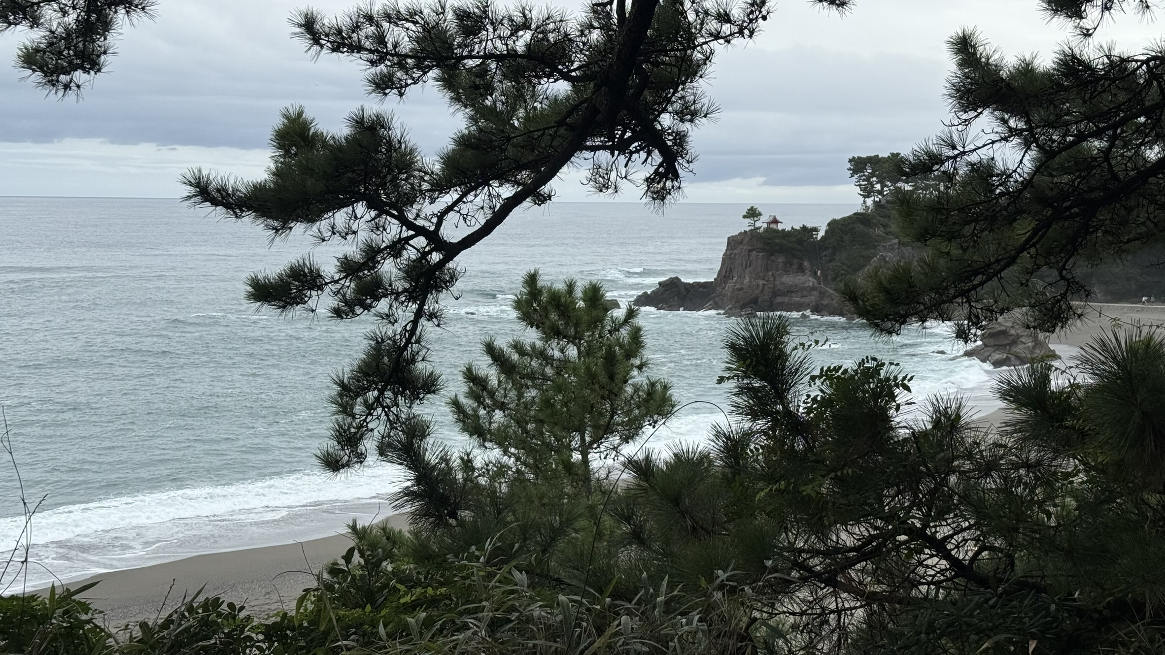
The Pacific Edge
Kochi’s southern coastline runs for roughly 350 kilometers. The western end reaches Cape Ashizuri (足摺岬), Shikoku’s southernmost point, where a lighthouse and several pilgrimage temples face the open Pacific. The eastern end reaches Muroto Cape (室戸岬), another exposed headland with coastal rock formations shaped by long exposure to the ocean.
Neither cape is organized for large-scale tourism. Access requires either a rental car or patience with infrequent local buses. What they offer is proportion: a position at the edge of the island facing a large ocean with little infrastructure between you and the horizon.
For a traveler spending several days in Kochi, the prefectural tourism approach works best with a rental car and no fixed itinerary beyond where the night will be. The rivers and the coast are separate enough geographically that choosing one area and staying in it produces a different experience from trying to see all of Kochi in a single pass.
For the small, precise pleasures that complement days outdoors along rivers and coast, the Savor piece on wagashi and the seasons is a useful companion to any slow travel in Japan. Japan’s traditional confections are made with the same attention to season and restraint that defines quiet travel in Kochi.
—
At the River’s End
The Shimanto flows into the Pacific at Shimanto City. The chinkabashi are still there in the evenings, their planks catching the last light. The fishermen are not performing anything. They are fishing. That is what the pace of Kochi offers: the chance to be in the same place at the same time, without adding much to it.